The Flood Map for Planning in England Update: Key Changes and Impacts for Developers
With the unveiling of the new Flood Map for Planning (FMfP) by the Environment Agency in England earlier this week, we asked our Associate Director for Water & Flood Risk, Claire Burroughs, what this means for the industry moving forward.
Claire’s review has looked at the new national flood data and the supporting Press Release published by the Environment Agency. Whilst it is evident that things have been updated, other aspects have remained consistent and follow-on from the previous FMfP.
KEY CHANGES
- The aims and objectives of the FMfP have not changed, and we still have Flood Zones and their classifications – these have not been altered.
- The FMfP is still guiding the allocation of development in relation to fluvial and tidal flood risk.
- It also still depicts the undefended situation for catchments and coastlines, meaning this update does not fundamentally change things for the Sequential or Exception Test.
THE DETAIL
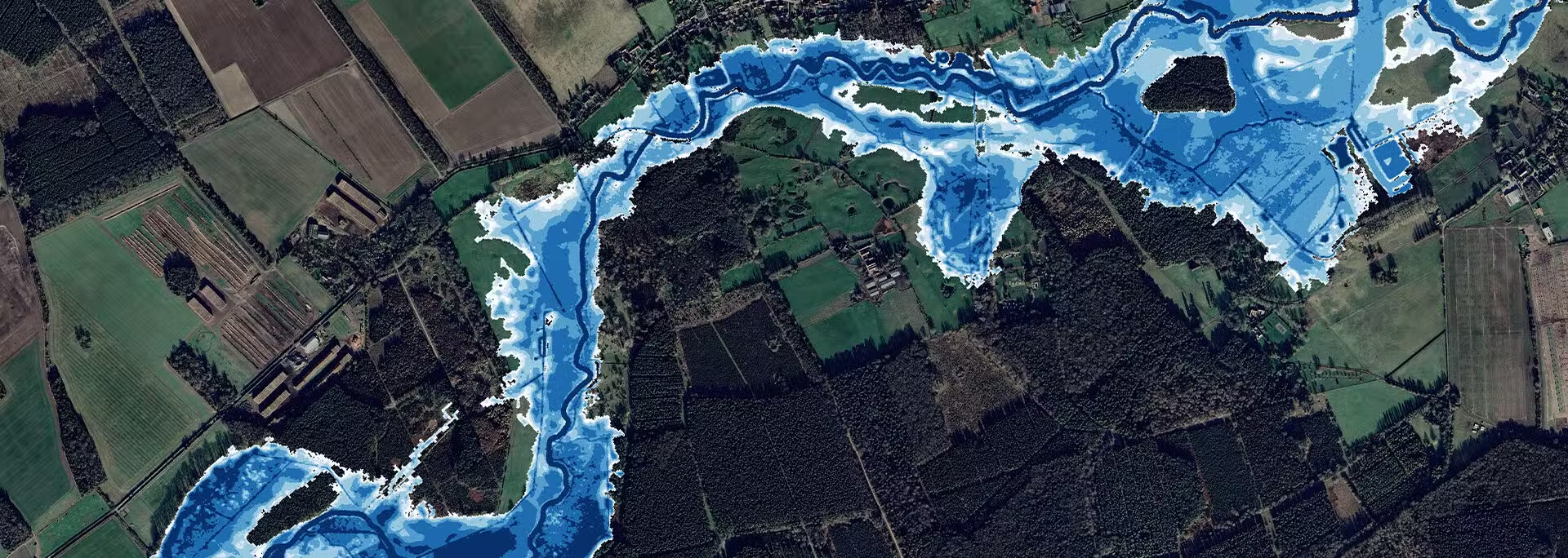
The mapping and modelling which supports the FMfP however has changed. It now covers catchments of over 3 km2, which means more areas in England have a comprehensive understanding of their risk of flooding from rivers or seas. This has resulted in new Flood Zone designations for some areas.
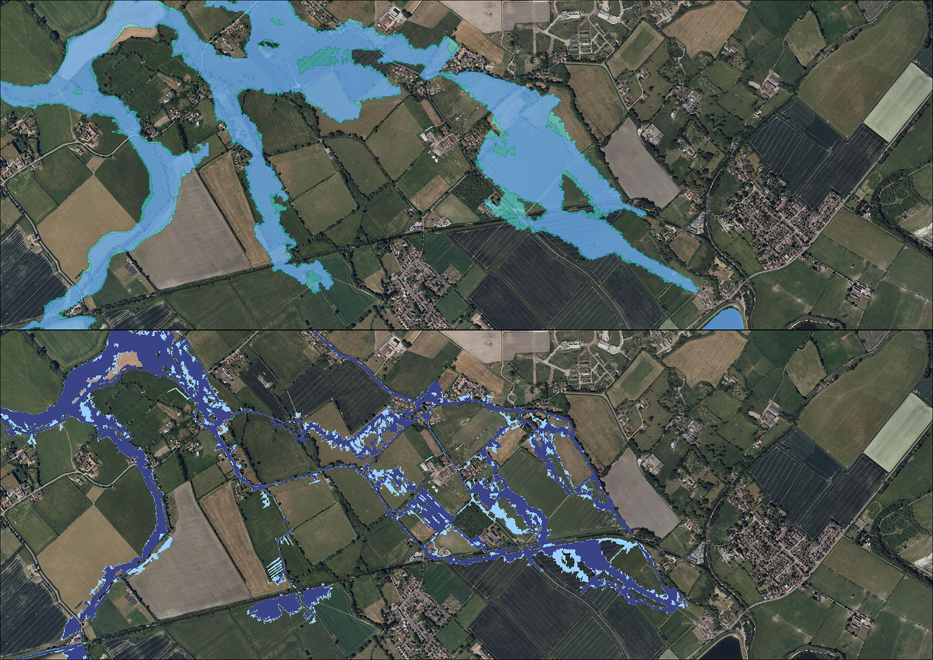
The FMfP mapping now also includes much more data at a public level. This new level of access will allow both the public and specialist consultants to review the risk of flooding from rivers and seas, with and without catchment defenses. From our perspective, this will help to provide us with a realistic view of flooding compared to the previous FMfP, which only depicted the Flood Zones. This more detailed mapping allows us to review the 30-year, 100-year for fluvial, 200-year for tidal, and 1000-year floodplain, including climate change uplifts where applicable.
IMPLICATIONS FOR FUTURE DEVELOPMENTS AND PLANNING APPLICATIONS
Flood risk consultants now have an indicative Flood Zone 3b classification, known as the functional floodplain, which is defined currently as the 30-year event. Very few developments are compatible with this Flood Zone. Prior to this change, gaining such detailed information required undertaking a Freedom of Information request for the detailed floodplains. This could take up to 20 working days to receive. Now, having this information online will greatly aid with assessments of sites proposed for future development.
The new FMfP relies upon the specific Environment Agency hydraulic modelling for rivers and coastlines and where detailed hydraulic models do not exist, the new national modelling which is depicted in the Long Term Flood Risk Maps for Rivers and Sea; is used. This has meant some areas have different floodplain and flow paths, which better reflect actual flood patterns. The Environment Agency has also stated that some areas of England are still covered by the original JFLOW FMfP modelling. For these areas, the Environment Agency aims over the next few years for these locations to be modelled more accurately.
It should be noted that FMfP has always been a ‘live’ database of the undefended floodplains for rivers and seas, and will continue to be so. This means it can be revised when better information is available. This can either be via the Environment Agency’s own modelling, Lead Local Flood Authority (LLFA) Strategic Flood Risk Assessment (SFRA) modelling or developer modelling through a Flood Map Challenge. The Environment Agency aims to update the FMfP several times a year. In our experience, these updates are not publicly announced in advance, reinforcing the importance of working with a competent flood risk professional who can verify the latest mapping during the design stage. This is essential for a successful planning application.
HOW WE CAN HELP
If your site is in a newly designated Flood Zone, if you are not sure what classification your site falls within, or if you need a comprehensive flood risk assessment, our experienced team are here to help.
Contact us today on 01603 877010 or email us at enquiries@createce.co.uk to discuss your project and ensure your planning application is fully compliant with the latest FMfP updates.
All categories