
OVERVIEW
Part of a wider Breckland renaturalisation initiative, the Thet and Little Ouse Natural Flood Management (NFM) project introduced nature-based interventions across seven sites along the River Thet and River Little Ouse upstream of Thetford. The scheme sought to restore chalk river ecosystems, reconnect floodplains, and reduce downstream flood risk through strategically placed NFM measures.
CREATE’S ROLE
Create was appointed to provide specialist hydraulic modelling, flood risk analysis, GIS support and technical review to inform, test and refine site-specific NFM interventions across the catchment.
Our commission began with a detailed review of three existing EA hydraulic models, updating hydrological inputs, land use parameters and topographic datasets to bring them to current industry standards and establish a reliable baseline for intervention testing.
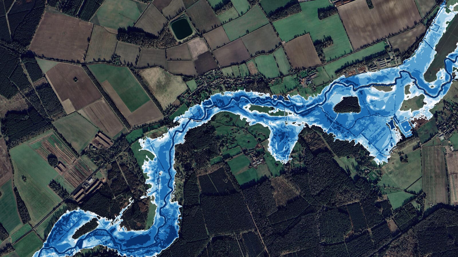
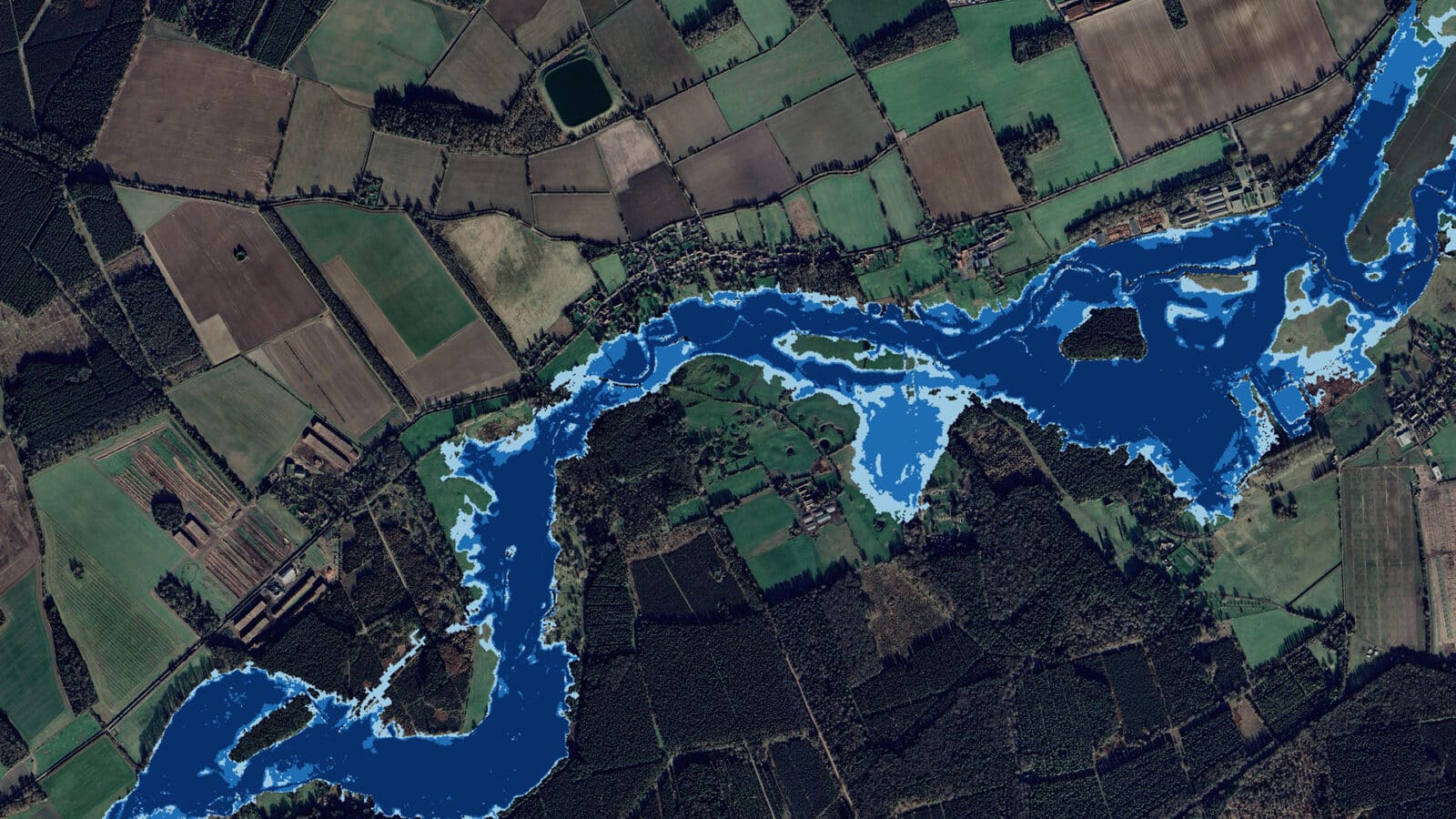
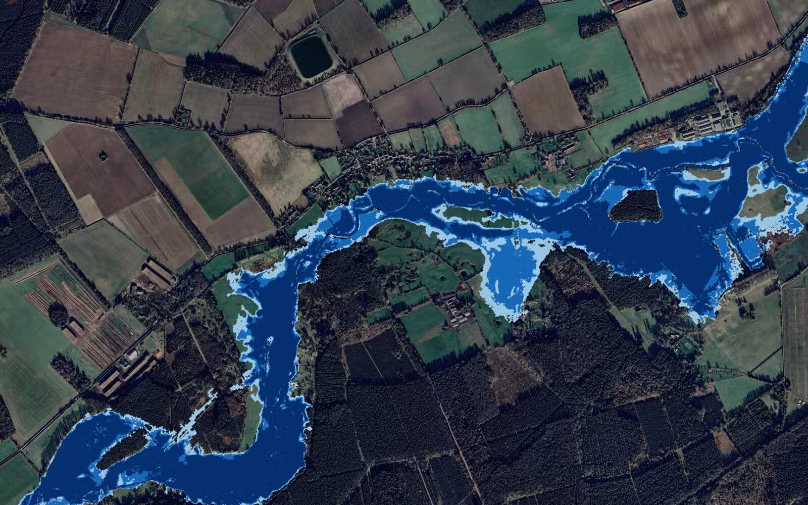
Using this modelling framework, we evaluated proposed NFM measures to quantify their off-site flood risk impacts while supporting improvements to floodplain function and ecological value. Interventions assessed included large woody debris installation, bank top lowering, ditch blocking and “stage zero” river realignment.
We undertook detailed GIS and LiDAR-based spatial analysis to identify optimal intervention locations and opportunities for floodplain reconnection. Low-flow analysis (Q5, Q50 and Q95) was carried out to inform ecological design, planting strategies and habitat restoration proposals.
Each intervention was modelled individually and cumulatively under a range of design storm events to test performance, identify potential unintended impacts and refine the overall strategy. Our modelling outputs supported collaborative decision-making and informed the evolution of a catchment-wide intervention approach.
Our roles, technical services and outputs included:
- Hydraulic Modelling Review
- Natural Flood Management Strategy
- GIS and Spatial Analysis
- Low Flow Analysis
- Intervention Impact Testing
- Ecological Integration
- Stakeholder Engagement
CHALLENGES
The project required the integration of hydrological modelling, ecological objectives and landscape restoration within a nationally significant chalk river catchment. Updating legacy hydraulic models to a consistent and reliable standard was essential before intervention testing could proceed with confidence.
Balancing measurable downstream flood risk reduction with habitat enhancement and low-flow ecological improvements demanded an iterative, evidence-led design process. The cumulative impact of multiple NFM sites also required careful testing to ensure flood storage benefits were realised without adverse consequences elsewhere in the catchment.
ACHIEVEMENTS AND BENEFITS
We delivered a robust, evidence-based flood risk assessment to support nine site-specific Natural Flood Management (NFM) interventions, underpinned by detailed hydraulic modelling and iterative testing. Our integrated approach enabled the development of NFM designs that not only reduce downstream flood risk but also enhance drought resilience and deliver measurable ecological improvements to chalk river habitats. Through cumulative catchment-scale impact analysis, we also demonstrated the wider strategic benefits of a coordinated intervention programme, while supporting sustainable land use practices and long-term ecological restoration within a nationally significant chalk river landscape.